Old, and Some New, Photographs of Woodbridge & Melton
The Navern Brook flowed down the valley between New Street and Castle Street. It then ran alongside Le Myll Lane until it entered the marshes by the Tide Mill. Today the flow of the Naverne Brook is much reduced and over much of its length it is now carried by underground pipes.
The earliest reference to Le Myll Lane being called Brook Lane is in the 1583 Court Rolls of Woodbridge late priory. By 1830 it was called Brook Street in the Woodbridge Poor's Rate Assessment. Yet, when Isaac Johnson produced his 1827 map of the town, he used the local name White Hart Lane. The White Hart Inn was a in building on at the junction of The Thoroughfare and Brook Street.
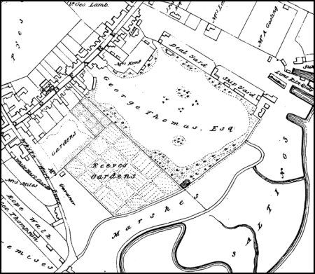
An extract from Isaac Johnson's map of the town in 1827 is displayed on the right. Apart from the buildings either side of the entrance to White Hart Lane there were only four other buildings abutting the lane.
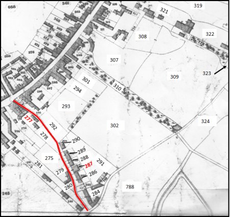
An extract from the 1840 tithe map is shown on the right.
Brook Street is highlighted by the red line. Between 1827 and 1840 nothing had changed on the western side of Brook Street, but a line 8 of houses had been built on the lower half of the eastern side. The rest of the land to the east of Brook Street was spit up into gardens, shrubbery and meadows.
Two of the new buildings that are worth commenting on. Firstly, in the middle of the line of houses on the eastern side of Brook Street there was a Wesleyan Meeting House (building no 287)
Secondly, on the western side Brook Street, just below the Throughfare, there was a large house (building 277). It was owned by Henry Edwards and Son - wine and sprit merchants and brewers since 1810. Below it there were two warehouses.
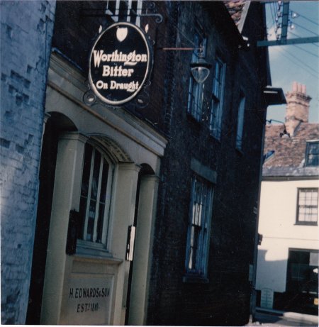
The White Hart Inn, which is believed to have started as a Gin Shop, was in part of the ground floor of the house and on the corner of the Throughfare and Brook Street.
The photograph on the right shows the Inn in early 1960s. It had two doorways on Brook Street - one for men and the other for women. Soon after the photograph was taken the building was demolished and was replaced by one which had 3 commercial units on the ground floor and flats on the two upper floors. In 2015 the ground floor was changed to create one large unit for W H Smith and a small unit for a coffee shop.
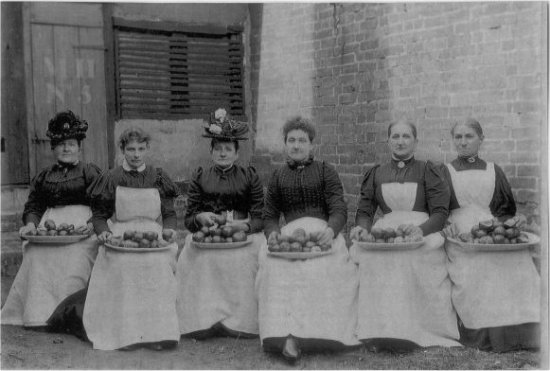
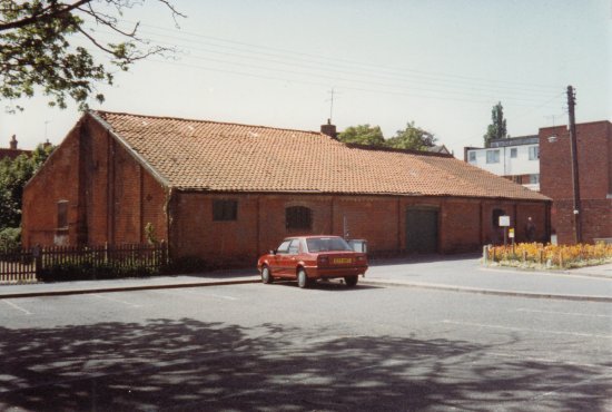
In 1871 a bonded warehouse was built in Brook Street by Henry Edwards & son who had been wine and sprit merchant merchants and brewers since 1810. One of their products was range of "high class pure fruit wines" the most popular of which was their orange wine. The company was still operating by 1937 and the female workforce used to sit outside the warehouse preparing the fruit. The warehouse was pulled down in 1997 to make way for the row of town houses along Jacobs's Way.
The bonded warehouse in Brook Street shortly before it was demolished in 1997.
Phot215
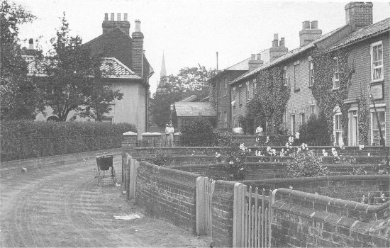
By 1840 there were two short terraces, and two detached houses, running along the western side of Brook Street. The first of the houses was at the entrance to Brook Street and the and the last of the houses was about half way up Brook Street. About two thirds of the line of houses can be seen in thee photograph on the right.
The two buildings on the on eastern side of Brook Street were added some time 1927.
Massive changes to Brook Street and eastern side of Brook Street after 1882. These are fully described in a article on Brook Street and the Turban Centre.