Evolution of the Town and its Maritime Trade
Maritime Trade from 1800 to 1850
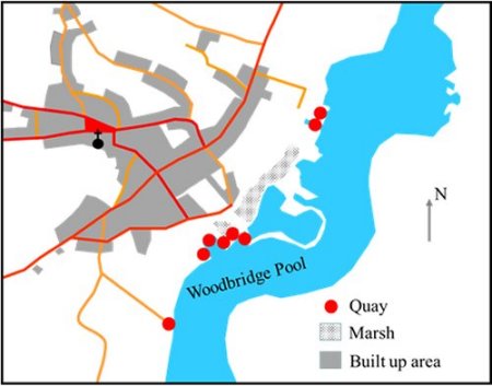
By 1801 Woodbridge was the 4th most populous town in Suffolk. The maritime trade was past its peak but all the quays shown on this map of the town in 1827 were busy. Two other quays were outside the area covered by the map. One was at Kyson Point to the south and the others were at Melton to the north.
Map of the town and its quays in 1827
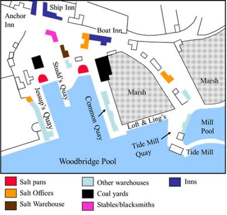
The main cluster of quays all served that area of the estuary called the Woodbridge Pool and they are shown in detail by this map.
Nearby the quays there were warehouses and salt pans. Salt had been collected from the gullies along the Deben for centuries and it was refined in Woodbridge until the late 1700s.
The quays serving Woodbridge Pool in 1827.
Corn was the principle export of the town and the principle imports were coal, oil cake (for cattle food) and timber from the Baltic. The vessels engaged in the trade were brigs and the more commodious topsails schooners. From the early part of the 19th century topsail schooners dominated trade.
The photographs below show at topsail schooner at anchor in the Woodbridge Pool and two along side the Common Quay.
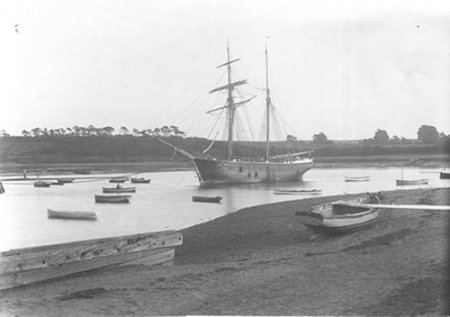
A topsail schooner at anchor in the Woodbridge Pool.
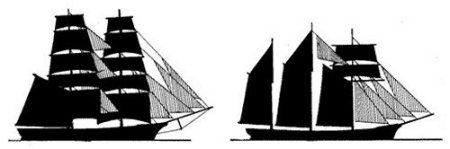
Silhouette of a brig Silhouette of a topsail schooner
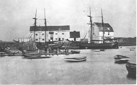
Two topsail schooners at the Common Quay