Evolution of the Town and its Maritime Trade
Maritime Trade from 1850 – A Period of Terminal Decline
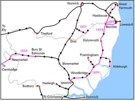
By 1859 the rail network in Suffolk was as shown on the right. The lines in black were all in service by 1849 while those in purple became operational on the dates shown.
The extent of the rail network in Suffolk by 1859. The lines
which were built from 1849 to 1859 are shown in purple.
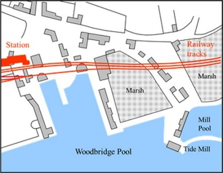
In order to keep the tracks as level as possible, the railway ran on the flat ground alongside the Deben estuary and skirted the top of the quays serving the Woodbridge Pool. The impact on the quays is shown on the right by overlaying the station and the tracks onto an 1827 map.
The railway tracks and station superimposed
in red on an 1827 map of the quays.
The railway had extensive goods sidings, a goods depot, cattle pens and a large grain store. These are all highlighted on the extract of the 1881 Ordnance Survey map shown on the right. The main up and down lines are coloured green while the goods lines and extensive sidings are blue. A goods line from the marshalling yard went to quays which were up river.
Plan of the railway station in 1881. The main
up and down lines are coloured green while
the goods lines and extensive sidings are blue.

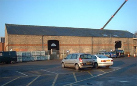
This photograph shows the grain store just before its conversion to a number of commercial units. Carts delivered corn to the large entrances and it was stored under cover before it could be loaded into railway wagons.
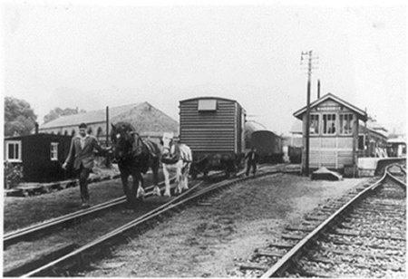
Horses were used to pull wagons on the goods lines by the station and along the goods line running to the quays up river.